
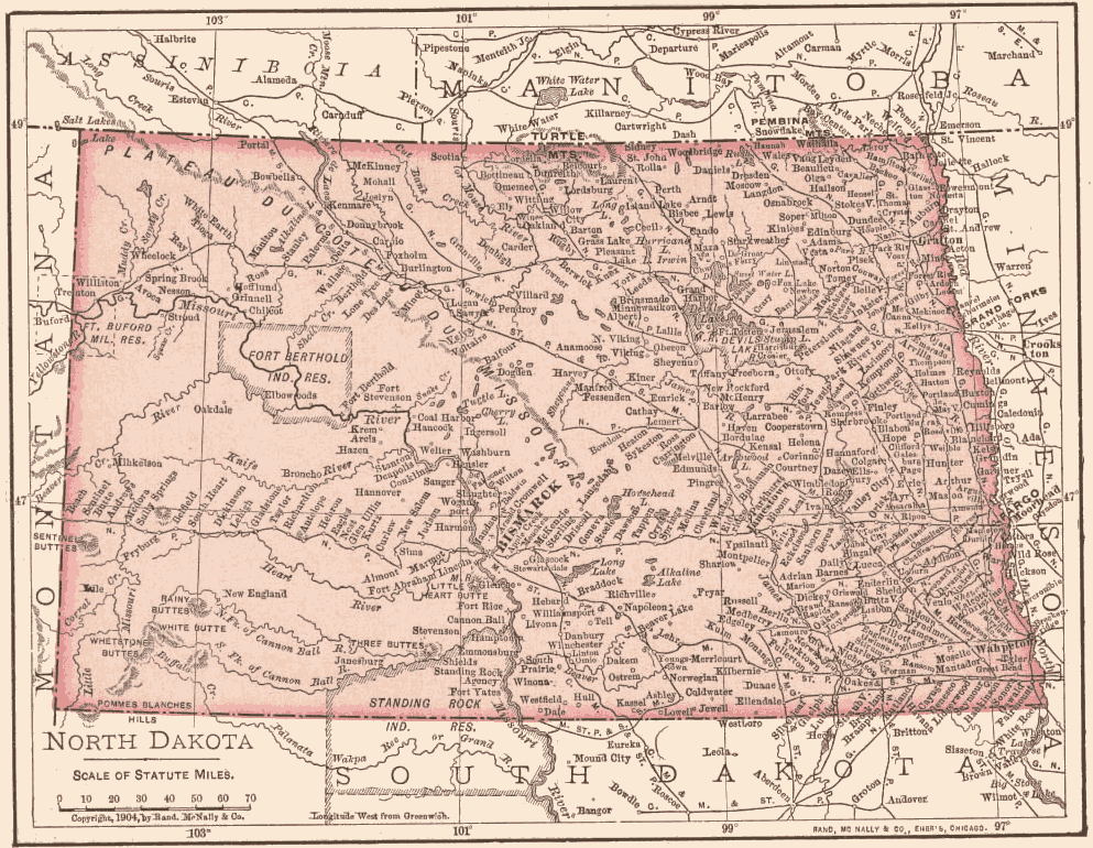
1904 NORTH DAKOTA MAP

North Dakota Towns of our Forefathers.
Notice that Mott, North Dakota is not on the map because it was founded in 1907, three years after this map was printed. Mott is located 34 miles straight south of Richardton on the north side of the Cannon Ball River. This is what the landscape looked like when the George ROLL (1867-1938) and Julia (STROH) ROLL
![]() 1995 Terraserver on-line aerial map (see "Topo", then view "Aerial").
1995 Terraserver on-line aerial map (see "Topo", then view "Aerial").
![]() North Dakota on-line map
North Dakota on-line map ![]() - MapQuest mapping web site.
- MapQuest mapping web site.