
North Dakota Towns of our Forefathers.
![]() 1995 Terraserver on-line aerial map (see "Topo", then view "Aerial").
1995 Terraserver on-line aerial map (see "Topo", then view "Aerial").
![]() North Dakota on-line map
North Dakota on-line map ![]() - MapQuest mapping web site.
- MapQuest mapping web site.
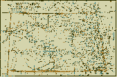 1891 North Dakota Map
 ![]() - A King Handbook map printed in 1891. (77K size)
- A King Handbook map printed in 1891. (77K size)
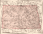 1904 North Dakota Map
 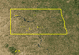 2000 Satellite View of North Dakota
 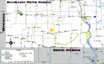 Southwest North Dakota Maps
  >
> 
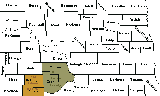
 Hettinger County Map
 ![]() - This map lists the Townships with Range grid locations.
- This map lists the Townships with Range grid locations.
 ROLL Family Homestead Map
  ROLL Family Homestead Aerial View
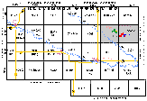
  Walker Township Maps
 ![]() - These maps show a 1910 and 2000 close-up of the sections where George ROLL (1867-1938)
- These maps show a 1910 and 2000 close-up of the sections where George ROLL (1867-1938) ![]() and Sebastian ROLL (1873-1930)
and Sebastian ROLL (1873-1930) ![]() homesteaded. The village of Willa is also listed.
homesteaded. The village of Willa is also listed.
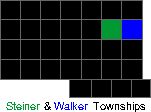
 Steiner Township Maps
  Mott, Hettinger County, North Dakota Maps
 ![]() - Maps and pictures of Mott, Hettinger County, North Dakota, USA. Mott is the county seat. Sebastian (1873-1930) and Julia KOFFLER LANTZ ROLL
- Maps and pictures of Mott, Hettinger County, North Dakota, USA. Mott is the county seat. Sebastian (1873-1930) and Julia KOFFLER LANTZ ROLL ![]() retired to a two-story home in southwest Mott. This home fell into dilapidation and was auctioned off in 1999 to the GION family in Regent, North Dakota. It was relocated next to the Regent Chamber of Commerce building and was fully restored as a bed & breakfast for travelers
retired to a two-story home in southwest Mott. This home fell into dilapidation and was auctioned off in 1999 to the GION family in Regent, North Dakota. It was relocated next to the Regent Chamber of Commerce building and was fully restored as a bed & breakfast for travelers